


PRECINCT 78, Delaware County, Indiana
About
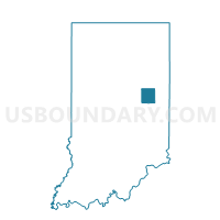
Outline

Summary
| Unique Area Identifier | 576864 |
| Name | PRECINCT 78 |
| County | Delaware County |
| State | Indiana |
| Area (square miles) | 35.37 |
| Land Area (square miles) | 35.27 |
| Water Area (square miles) | 0.11 |
| % of Land Area | 99.69 |
| % of Water Area | 0.31 |
| Latitude of the Internal Point | 40.26650230 |
| Longtitude of the Internal Point | -85.51951350 |
Maps


Graphs
Select a template below for downloading or customizing gragh for PRECINCT 78, Delaware County, Indiana


Neighbors
Neighoring Voting District (by Name) Neighboring Voting District on the Map
- MONROE 8, Madison County, IN
- PRECINCT 56, Delaware County, IN
- PRECINCT 57, Delaware County, IN
- PRECINCT 69, Delaware County, IN
- PRECINCT 70, Delaware County, IN
- PRECINCT 71, Delaware County, IN
- PRECINCT 77, Delaware County, IN
- PRECINCT 90, Delaware County, IN
- PRECINCT 93, Delaware County, IN
- RICHLAND 01, Madison County, IN
- VAN BUREN 01, Madison County, IN
Top 10 Neighboring County Subdivision (by Population) Neighboring County Subdivision on the Map
- Mount Pleasant township, Delaware County, IN (14,102)
- Monroe township, Madison County, IN (8,786)
- Hamilton township, Delaware County, IN (7,206)
- Richland township, Madison County, IN (4,775)
- Harrison township, Delaware County, IN (3,377)
- Union township, Delaware County, IN (2,838)
- Washington township, Delaware County, IN (2,027)
- Van Buren township, Madison County, IN (1,861)
Top 10 Neighboring Place (by Population) Neighboring Place on the Map
Top 10 Neighboring Unified School District (by Population) Neighboring Unified School District on the Map
- Anderson Community School Corporation, IN (71,503)
- Delaware Community School Corporation, IN (15,007)
- Mount Pleasant Township Community School Corporation, IN (14,102)
- Alexandria Community School Corporation, IN (8,786)
- Madison-Grant United School Corporation, IN (8,645)
- Wes-Del Community Schools, IN (5,404)
Top 10 Neighboring State Legislative District Lower Chamber (by Population) Neighboring State Legislative District Lower Chamber on the Map
Top 10 Neighboring State Legislative District Upper Chamber (by Population) Neighboring State Legislative District Upper Chamber on the Map
Top 10 Neighboring 111th Congressional District (by Population) Neighboring 111th Congressional District on the Map
Top 10 Neighboring Census Tract (by Population) Neighboring Census Tract on the Map
- Census Tract 24.02, Delaware County, IN (8,662)
- Census Tract 26.01, Delaware County, IN (7,206)
- Census Tract 25, Delaware County, IN (5,404)
- Census Tract 105, Madison County, IN (3,434)
- Census Tract 107, Madison County, IN (3,229)
- Census Tract 101, Madison County, IN (3,070)
- Census Tract 26.02, Delaware County, IN (2,838)
Top 10 Neighboring 5-Digit ZIP Code Tabulation Area (by Population) Neighboring 5-Digit ZIP Code Tabulation Area on the Map
- 47304, IN (30,516)
- 47303, IN (25,365)
- 46012, IN (19,414)
- 46001, IN (10,459)
- 47396, IN (7,030)
- 47334, IN (3,263)
- 47342, IN (2,693)
- 46070, IN (2,351)